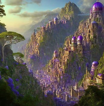

Ghanidash


Los Daniagos

Kotopexi

Kobama
Summary
The Ghani and the peoples of the Taysha Confederacy are located in the western portion of Mir’s largest landmass, south of the Saden Mountains and north of Mikhailistan.
Ghanidash stretches from icy Jorvik to the fertile Cornuchuan Plains. Multiple shipping ports, including a large harbor near the capital city of Daniagos, make Ghanidash a hub for trade in agricultural products.
At the same time, climate change has dramatically impacted the country. Recent international financial shocks have also produced drastic political changes and economic hardship.
Ghanidash’ s democratic system has seen major turnover in governments since the Hadian War. Despite promises to the contrary, the most recent government was forced to enter into a long-term loan agreement with the Mirian International Fund (MIF). The uneven costs of climate change have also given rise to new popular support for a major change in public policy.
Ghanidash is the home of the indigenous Oxori, Ha’pas, and Kotos of the Taysha Confederation. In this context of economic turmoil, the Confederation has recently taken a more prominent role in promoting alternative models of economic growth.

Parta Mara
Laurograd

Jorvik

Ha'Pa,La

Abbaba
Geography and Resources
Location: north-west Mir
Agriculture: wheat, corn, potatoes, cherries, peaches, peppers, plums, etc.
Natural Resources: sand and gravel, cement, coal, lime, nitrogen, phosphate
Climate: subarctic, temperate, alpine continental, high-peaks, Mediterranean
Horticultural Zones: 3-8

Oxoro

Nevetra
People and Groups
Population: 113.6 million (Rank 3)
Median Age: 31.3 years (Rank 2)
Life Expectancy: 73.1 years (Rank 2)
Net Migration Rate: medium immigration
Ethnic Groups:
Ghani 65%
Ölafen 15%
Kotos 12%
Oxori 8%
Ha'pas 2%


Parta Plata

Ha'Pa,La - Sacred Hall
Environment and Energy
Vegetation: tundra, northern and alpine forests, great fertile plains,
Pollution Sources: heavy industry, mining, industrialized agriculture, urbanization, deforestation
Climate Change: melting permafrost and glaciers, increased wildfires and flooding, warming winters, hurricanes
Energy Sources:
Coal: 40% Solar: 3%
Oil and Gas: 45% Wind: 2%
Biomass 5% Hydro: 5%

Mokeng River

Mir Seed Sanctuary
Government
Type: liberal democracy
Cabinet Members:
Prime Minister
Leader of the opposition
3 representatives:
Agriculture
Taysha Confederacy
Military
Elections: regular, free, fair
Judicial System: largely independence

Acio

Ira'mas
Economy
GDP: 800 billion
GDP per capita: 7 300
Economic Sectors:
Services 63%
Manufacturing 30%
Agriculture 7%
Imports: Energy
Exports: Food
Starting Budget: 600

Sedan Mountains

Monta Saden
Military
Weapons: limited supply
Technology: basic
Cyberwarfare Capabilities:
Defense Some
Intelligence Some
Offensive Weak
Nuclear Weapons: 0
